Line-Of-Sight Revisited: Card-Based Overland Travel
Land surveying is one of my favorite frames for a true-to-life adventure. It requires skill, dedication, time, and logistics. This is why it is a concept I've wanted to explore in the tabletop space for years now. I experimented with it as a framing device for a Dungeons and Dragons campaign, but the superheroics of fifth edition are pretty incompatible with the day-to-day decision-making of an overland survey. This past year I chewed on a bespoke system and playtested a few ideas, but I found myself constantly frustrated.
The core incongruity I have been fighting is that surveying and cartography are the necessary first steps to developing a birds-eye-view map of an environment, but I could not conceptualize a procedure or mechanic that would allow players to start from a first-person view. It could have been a failure of imagination, but my ideas always orbited around some initial, known top-down map. This could then be translated to play for the characters, but it begged "what are we playing to find out?"
I let this return to the backburner while I revisited other projects and got to a first draft of The Wax Marches, which tackles this problem head-on by allowing players to get a bee's-eye view of the world. I have still been interested in a solution to this problem, however, and one potential idea started to crystallize right around the same week that Valeria posted People Walk Too Fast. As she says, you can see about three miles away to an unobstructed horizon. Now she correctly points out that an adult can walk to that horizon in about an hour, but I will defer to Robert Erskine, the first Geographer and Surveyor General of the Continental Army:
It is obvious, that in planning a Country, great part of the ground must be walked over, particularly the banks of Rivers and Roads: as much of which may be traced and laid down in three hours, as could be walked over in one; or in other words, a Surveyor who can walk 15 miles a day, may plan 5 miles; if the Country is open, and Stations of Considerable length can be obtained, then perhaps greater dispatch may be made: very little more, however, in general can be expected.
If we are actively surveying the land between where we currently stand and the visible horizon, that is probably a day's worth of work. Valeria points out that this issue of communicating what is visible to players is part of the challenge of making hex crawling interesting and gameable, but we are not talking hexcrawls today; we are talking line of sight navigation. Our survey team knows the general direction that it is going and our goal is to make a game out of the decisions that must be made to get there. How can we create something like a "vision cone" that informs a player what is between them and the horizon?
Framing it as a vision cone is what broke the initial logjam. I am typically fiddling with a deck of cards when I work on design issues, and I started by dealing myself a pyramid of 10 cards. 1, 2, 3, 4 all in rows, and I just looked at the relationships of the cards in this orientation. Was this a game yet?? Obviously no. But I liked the shape of it, it was pleasing. It felt like it provided some combination of branching paths from the row of 1 to some point in the 4th row. I let this percolate for a month, but to cut to the chase here is what I noodled on today.
A Line of Sight Capsule Concept
You are a survey crew tasked with drawing a border between two states. The border region is thickly wooded and mountainous and every previous attempt to survey the border has failed. The path you take from the eastern coast to the Inland Sea will parcel out land and resources in turn to the two bickering states.
First, take a tarot deck (I used my Royal Blood deck) and separate it into Major Arcana, Minor Arcana Face Cards, and Minor Arcana numbered cards (Ace-10).
Draw two Major Arcana cards for the northern state and two Major Arcana cards for the southern state. These cards represent the agents of each of the states who have commissioned your survey; the sum of the cards for each side represent the relative social and political power held by the sides as of today. I can see each Agent imposing unique rules, constraints, and objective functions for the survey.
Draw three Minor Arcana Face cards to represent your Surveyor, your Astronomer, and your Steward (I didn't make any unique rules for these yet, it just gave them some character).
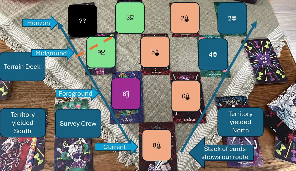
Take an Ace from the Minor Arcana numbered cards and place it face-up in front of you. Now deal 9 cards face-down in a pyramid expanding away from you. Reveal the row of two cards nearest you.
Since you are starting at sea level, an Ace, you can't see beyond these two cards unless one or both of them are also Aces. The ranks of these cards represents a relative change in elevation If the rank of one of the revealed cards is within 3 of your current position, then you can safely travel to that point and set a survey marker; this yields all of the territory in line with the other card to one of the two states.
If neither direction can be safely traversed, then you must choose a direction to travel and face some form of traversal challenge, hazard, or obstacle.
After you choose a direction of travel, your pyramid of cards moves toward you and you may deal another top row of four. If the relative elevation of your current position meets or exceeds the cards in your line of sight, then you may reveal the next row of cards. If your current position is higher than the cards in this midground range band, then you can see clearly to the horizon. Your line of sight is blocked by cards of higher elevation and you can never see past the horizon.
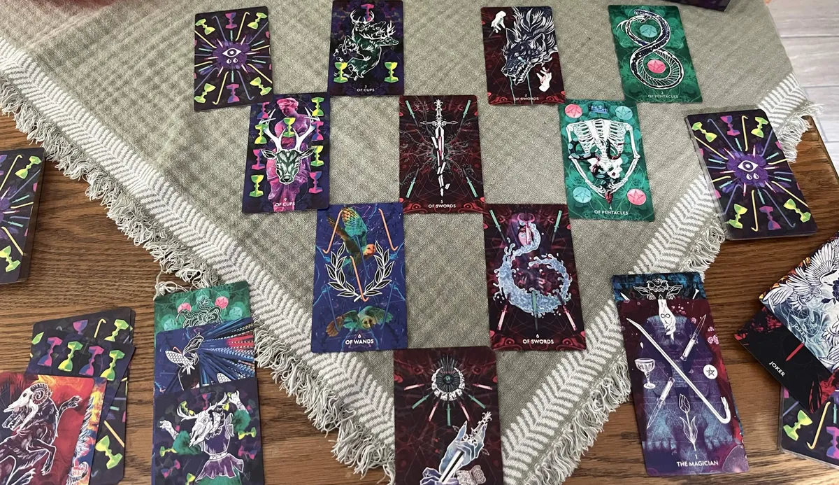
As an example of what this spread of cards looks like, first here is a picture that shows off how disgustingly stylish the Royal Blood deck is.
And now here's an annotated photo that hopefully better communicates what I'm getting at.
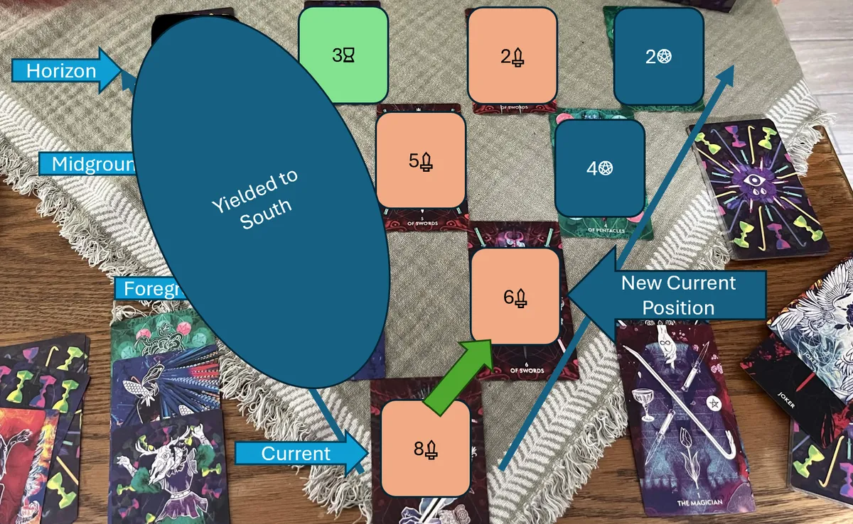
If we decide to traverse downhill to the 6 of Swords, then the leftmost cards are yielded to the southern state and we progress onward into the mountains.
So over the course of a brief session, you assemble a deck of cards yielded to the south, a deck of cards yielded to the north, and a deck of cards representing the route that you've taken to map the border. I have a smattering of ideas of how different suits reflect different resources, or ways to make traversal challenges a game in and of themselves, or ways to marry this new concept to some of the ideas we explored in Surveyed by the Apocalypse and other design journals, but in the immediate term I just feel so much more satisfied with this as a core driver of this navigational concept. This could either be a little capsule zine game that you play like solitaire, or maybe it can be more of a complete multiplayer RPG, but it feels like it has some legs that have me excited again!
Let me know if you've experimented with similar first-person traversal systems or how you've squared this circle!